Mount Gerizim
Mountain in the West BankMount Gerizim is one of two mountains near the Palestinian city of Nablus and the biblical city of Shechem, located in the north of Palestine’s West Bank. It forms the southern side of the valley in which Nablus is situated, the northern side being formed by Mount Ebal. The mountain is one of the highest peaks in the West Bank and rises to 881 m (2,890 ft) above sea level, 70 m (230 ft) lower than Mount Ebal. The mountain is particularly steep on the northern side, is sparsely covered at the top with shrubbery, and lower down there is a spring with a high yield of fresh water. The mountain is mentioned in the Hebrew Bible as the place where, upon first entering the Promised Land after the Exodus, the Israelites performed ceremonies of blessings, as they had been instructed by Moses.
Read article


Top Questions
AI generatedMore questions
Nearby Places

Balata Camp
Refugee Camp in Nablus, State of Palestine
Har Brakha
Israeli settlement in the West Bank

Mitzpe Yosef
Place
Kafr Qallil
Municipality type D in Nablus, State of Palestine

Al-Khadra Mosque
Mosque in Nablus, West Bank, Palestine
Kiryat Luza
Samaritan village in West Bank

Yeshivat Har Bracha

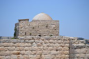
Mount Gerizim Temple
Samaritan temple (5th century–c. 110 BCE)